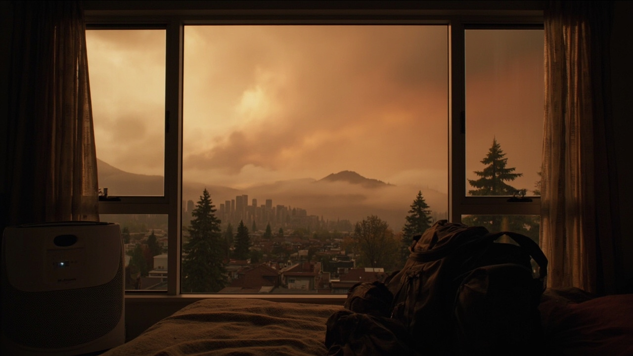
TL;DR: Households across Washington and Oregon should stay indoors, seal homes, and track official air-quality alerts on Aug. 6 as wildfire smoke drives unhealthy air and heat near 90 degrees.
What happened on Aug. 6
Early on the morning of Aug. 6, Seattle and Portland ranked in the top 10 major cities for worst air quality in the world, according to IQ Air's tracker, as reported by USA Today in "Wildfires spread hazardous smoke across multiple states. See maps." Pockets of pollution ranging from unhealthy for sensitive groups to hazardous to all people were spreading in parts of Washington, Oregon and western Idaho while firefighters worked to contain blazes.
There were 49 uncontained large fires burning in Washington and Oregon as of Aug. 6, according to the National Interagency Fire Center, with 94 active, uncontained large wildfires burning across the whole country, according to the center and USA Today's Aug. 6 report. The Northwest was seeing the largest fire activity in the nation at that time.
In Washington State, the Sinlahekin Fire, caused by lightning about 12 miles west of Tonasket, had burned more than 120,000 acres since July 26. The Little Giant Fire, also caused by lightning on July 15 about 30 miles northwest of Leavenworth, had grown to 74,000 acres, USA Today reported.
Oregon fires including the Big Grass blaze at 358,959 acres, Coleman Creek at 309,803 acres and Rowe Creek Complex at 344,834 acres were among the nation's largest, the National Interagency Fire Center said through the same USA Today report. Three major wildfires in the Spokane, Washington, area had forced tens of thousands to evacuate and destroyed hundreds of homes and other structures.
The Spokane Complex, which consists of the Old Trails Fire, Fairview Fire and the Autumn Lane Fire, had been active since Aug. 1 and had burned more than 10,500 acres. The three blazes were believed to be human-caused, and one person, 37-year-old Aaron F. Farinacci, was arrested and charged with arson in the Old Trails Fire, according to USA Today's Aug. 6 account.
Western Washington heat and smoke alert
There was another hot and hazy day ahead for most of Western Washington, where high temperatures could approach 90 degrees on Thursday as smoke from wildfires made the air unhealthy for some to breathe, forecasters said in The Seattle Times report "Western WA weather: Wildfire smoke clogs air as temps near 90 degrees."
The National Weather Service issued an air quality alert lasting until 5 p.m., warning people with health concerns to limit their time outside and follow tips to keep indoor air clean, like keeping windows and doors closed and using air purifiers, according to that Seattle Times report published Aug. 6. A heat advisory was also in effect until 10 p.m., with high temperatures in Seattle expected to come just two degrees shy of the city's 91-degree record for Aug. 6.
National Weather Service forecaster Dana Felton told The Seattle Times that fires burning were producing large volumes of smoke and that asthma and any sort of respiratory issue would be exacerbated. Felton said east-blowing winds arriving Thursday night were expected to push smoke away from Western Washington through next week.
"There is improvement on the horizon," Felton said in The Seattle Times report, adding that by tomorrow afternoon people would definitely notice an improvement. The region would likely get progressively cooler through the weekend, with high temperatures in the mid-80s on Friday and low 80s on Saturday.
By Sunday, conditions should be "returning more to normal," with sunny skies and highs in the mid-70s, according to the weather agency as quoted by The Seattle Times. That forecast gave households a timeline for planning outdoor work, childcare, and ventilation.
Where smoke was coming from
Multiple large fires were burning across Washington with no rest in sight for firefighters, the Washington State Department of Ecology wrote in "Explosive wildfire activity spreads smoke across Washington." Spokane experienced devastating wildfire impacts over the weekend and the situation was still very active, with hundreds of structures burned, causing potentially hazardous air quality on top of the tragedy.
Unhealthy to Very Unhealthy air quality continued to inundate many parts of the state and more areas were expected to see smoke impacts later that day and through the week, Ecology reported. As winds shifted, smoke was expected to cover the Columbia Basin and travel over parts of Western Washington, including the Seattle metro area.
A strong high pressure system off the coast was expected to persist that week, resulting in hot and dry conditions and winds coming from the north-northeast, according to Ecology. That pattern would allow smoke to engulf most of Eastern and Central Washington through the week, while haze would also be visible in Western Washington and smoke was expected to mix down into the Puget Sound lowlands.
Ecology listed Eastern Washington large active fires as the Autumn Lane Fire, Old Trails Fire, Mitre Rock Fire, Modrite Fire, Hudspeth Fire, Bradeen Hill Fire, Kaiser Canyon Fire, and Paradise Fire. Central Washington large active fires included the Little Giant Fire, Sinlahekin Fire, Ptarmigan Fire, Luna Fire, and the Border 2 Fire, with fires to the north in British Columbia also continuing to burn.
Ecology advised residents to check with local emergency response organizations for evacuation notices and recent updates and to consider using the nonprofit Watch Duty for crowd-sourced information. That step matters for households near fast-moving perimeters because local officials issue the evacuation notices.
Air Quality Alerts in effect
Air Quality Alerts had been extended to all of Eastern and Central Washington until further notice, according to Ecology. Air Quality Alerts were also being issued that day for parts of Western Washington, including Pierce, King, Snohomish, Kitsap, and Thurston counties until Wednesday afternoon.
Additional alerts could be issued for other counties in Western Washington if conditions deteriorated, Ecology said. Households should therefore recheck county-level alerts even if skies looked clearer in the morning, because fire and smoke would be very dynamic over the next few days.
The AIRPACT project also helps regulators let people know when there will be poor air quality, whether from inversions, ozone or wildfires, Northwest Public Broadcasting reported in "As smoke covers Northwest skies, an interactive map helps forecast air quality." The project provides information for agencies to help make decisions on health advisories and burn bans.
New three-day smoke forecast tool for the Northwest
If residents were wondering whether it would still be smoky over the weekend, an interactive tool could help forecast smoke throughout the Northwest, Northwest Public Broadcasting reported Aug. 6. The interactive forecasting map from Washington State University predicts local air quality conditions over a three-day period.
"Think of it like a weather forecast, but for the air we breathe," said Jun Meng, an assistant professor in the Department of Civil and Environmental Engineering in WSU's Voiland College of Engineering and Architecture, in a news release quoted by Northwest Public Broadcasting. Meng said people checking weather for weekend plans were becoming more aware of air quality and the need for this kind of forecast with the intensifying wildfire situation.
The tool is an update to a long-term air quality forecasting project called AIRPACT, which was one of the first high-resolution forecasting tools when it premiered in 2001. The AIRPACT project originally started in the Seattle area to monitor things like wintertime inversions and wood stove use, said Farren Thorpe, a natural resource scientist with the Washington Department of Ecology who had worked with AIRPACT for around 20 years.
The project quickly expanded to include the rest of Washington, Oregon and Idaho, and wildfires became a really big, important concern for forecasting, Thorpe said in the Northwest Public Broadcasting report. This update, which took about a year to develop, is part of AIRPACT6 and pulls data from satellites, meteorological information and emissions data.
Along with wildfire smoke and ozone concentrations, the interactive map can show where current wildfires are burning and can add in weather conditions. Meng said different neighborhoods could show different concentrations due to different wind conditions and where fires are located, and the model is customized to the Northwest because of different vegetation types and complex terrain like mountains and valleys.
The tool does not work well on cellphones because of the many pop-up options, Meng said, but he hoped citizen scientists could use it to figure out long-term air quality trends in their area because the tool allows people to look at the history of specific locations. In the future, Meng said he would like to include fire behavior in the forecasts and look more deeply at the types of toxics in different smoke. The tool was sponsored by the NW-AIRQUEST Consortium, which includes agencies and universities from Washington, Oregon and Idaho.
How to protect your household from smoke and heat
When smoky conditions are this widespread, it is important to stay inside where there is cleaner indoor air, Ecology advised. Residents should run portable air cleaners or consider making a box fan filter, set HVAC systems to recirculate, and consider wearing an N95 mask to protect health if they must go outside.
Residents can find clean air shelters listed on the 2-1-1 site, Ecology said. In addition to smoke, health impacts can be amplified when it is hot and smoky, so residents should pay attention to any symptoms and check the Department of Health resources on how to protect from smoke.
Wildfire smoke can cause symptoms such as burning eyes, runny nose, scratchy throat, difficulty breathing, headaches and bronchitis, according to USA Today's Aug. 6 health summary. Those most at risk include children, older adults, people with health conditions including heart or lung disease, and those who are pregnant.
Experts say the best way to stay safe from wildfire smoke is to stay inside, USA Today reported. If residents must go outside, they can wear an N95 or similar face mask to protect from breathing dangerous particulates in smoke.
While inside, residents should keep windows and doors shut and can run air purifiers or make their own, with one example being a Corsi-Rosenthal box made from simple materials that include an air filter, box fan and duct tape. Residents should not use fireplaces, candles or vacuums, and should not smoke indoors during smoke events, according to that same USA Today guidance summary.
As an evolving research project, AIRPACT users should still pay attention to official advisories, Meng said through Northwest Public Broadcasting. That means using the three-day map for planning, but treating National Weather Service alerts, Ecology Air Quality Alerts, and local emergency instructions as the controlling guidance for health and evacuation decisions.