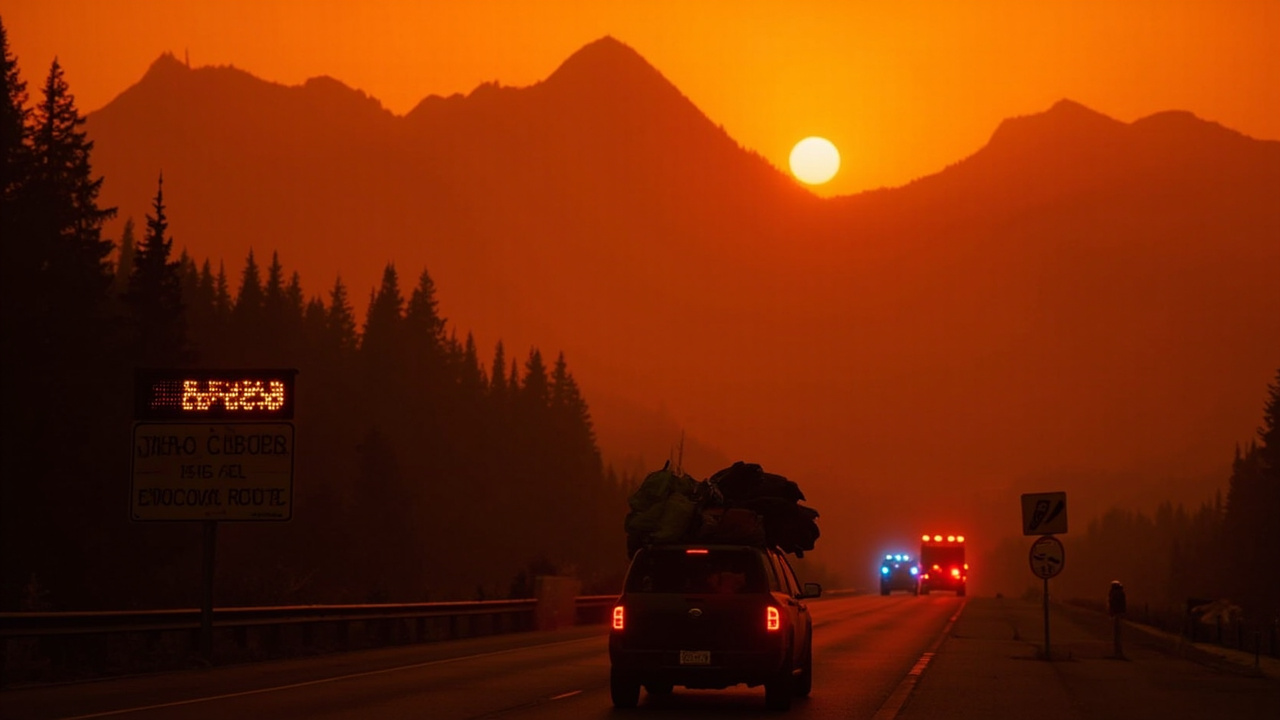
TL;DR: Evacuation orders remain active in 14 Oregon counties and parts of Washington on September 14, while Okanogan County ended all Sinlahekin Fire evacuation orders on September 12.
Orders Stay In Place Across Two States
Mandatory evacuation orders and public warnings continue across a wide band of central and eastern Oregon and north-central Washington as several large wildfires keep burning. County sheriffs, not fire crews alone, decide when residents may return, so improving weather has not automatically cleared any Level 3 zone.
In Oregon, evacuation orders affect Baker, Clackamas, Crook, Deschutes, Gilliam, Grant, Harney, Hood River, Jefferson, Sherman, Umatilla, Union, Wasco and Wheeler counties, according to Healthcare Ready tracking cited by Evacuation Orders Remain Active Across Oregon and Washington; Okanogan County Lifts Sinlahekin Restrictions — NW FireWatch. Orders also cover portions of the Confederated Tribes of Warm Springs reservation. That report links Clackamas and Hood River actions in part to the Austin Fire southeast of Estacada, and Umatilla and Union actions in part to the Paradise and Hagen fires.
In Washington, Level 1 through Level 3 designations remain around the Lake Chelan corridor because of the Little Giant Fire, which has burned 172,695 acres across Chelan and Okanogan counties. The same regional summary notes additional orders and warnings near Tonasket, Inchelium and sections of the Spokane metropolitan area. Households in every zone should know the three-tier meaning used in both states: Level 1 means get ready to leave on short notice, Level 2 means prepare for imminent departure, and Level 3 means leave at once under a mandatory order.
What The Sinlahekin Lift Covers
Okanogan County officials lifted every evacuation order and advisory tied to the Sinlahekin Fire on September 12. The fire burned 166,026 acres and at its height displaced hundreds of households before shifting into mop-up and monitoring.
The change does not reopen all public land. Reporting from Spokane outlet KHQ on September 13 said U.S. Forest Service, Bureau of Land Management and Loomis State Forest closures remained in effect after the evacuation lift, while suppression-repair crews worked in the western portion of the burn. That report placed the fire at 76% contained with 771 personnel still assigned.
Returning residents face lingering ground hazards. The NW FireWatch evacuation summary warns about trees weakened by heat that can topple without warning, stump cavities that retain heat for weeks, slopes and stream banks subject to erosion, buildings with compromised structure, and smoke from smoldering interiors. KHQ added that burned terrain can include loose rock, unstable trees and drainage crossings that change quickly during storms.
County officials and fire managers ask returnees to give emergency equipment the right-of-way, keep vehicles off road shoulders where crews operate, and observe every posted closure.
Oregon Spotlight: Austin, Paradise, McCully And Grasshopper
Austin Fire In Clackamas County
The Austin Fire continues burning southeast of Estacada inside Mt. Hood National Forest. Austin Fire: Level 3 Evacuations Remain in Clackamas County Despite Rain and Cooler Conditions — NW FireWatch, published September 14, reports approximately 12,610 acres burned with only partial containment. Investigators determined the ignition was human-caused. Fire behavior was described as creeping and smoldering after rainfall and cooler air, with crews reinforcing perimeter lines.
The Clackamas County Sheriff's Office keeps Level 3 Go Now orders in effect for parts of the upper Clackamas River corridor. Highway 224 stays closed east of milepost 39 at Fish Creek, with checkpoints staffed around the clock. Trails, forest roads and recreation sites in the affected Clackamas River Ranger District are largely off limits. The September 14 report notes no red flag warnings were active that Sunday, with seasonal fire potential low statewide but a midweek warming and drying trend plus light to moderate winds expected to somewhat increase activity.
Residents are told not to reenter a Level 3 area until the sheriff and incident management formally lift the order. Entering without authorization is unlawful and dangerous.
Paradise Fire Near State Line
The Paradise Fire, originating around Paradise Creek and the Mill Creek watershed in Walla Walla County, Washington, affects evacuations on both sides of the state boundary. Coverage by Apple Valley News Now, updated September 14, lists the size at 9,654 acres and containment at 49%, citing the National Interagency Fire Center.
That update lists no Level 2 evacuations currently, with Level 1 Be Ready designations remaining for Green Fork and Burnt Fork in Columbia County and for zones UMC-032 and UMC-039 through UMC-041 in Umatilla County, Oregon. An 11:45 a.m. update on September 14 said all Level 1 and Level 2 orders for Walla Walla County and Umatilla County had been lifted, while orders for Columbia County areas had not yet been officially lifted. The designated emergency shelter was Neighbor 2 Neighbor Pendleton at 715 SE Court Ave. in Pendleton, Oregon. Roads inside the Umatilla National Forest portion remain closed to the public.
Oregon Fire Roundup: McCully, Sycan, and Paradise Fires Remain Active as Rain Brings Brief Relief — NW FireWatch places the Paradise incident in mop-up and rehabilitation, with crews repairing lines and removing timber hazards along roadways. It warns of deep ash pits and unstable trees and says closed forest areas face increased patrol.
McCully Fire In Baker And Grant Counties
The McCully Fire on the Wallowa-Whitman National Forest remains one of Oregon's more complex incidents. The September 14 roundup says Level 1, Level 2 and Level 3 warnings remain active there, even as operations shift toward line rehabilitation and suppression repair. Emergency area closures remain, and crews are clearing hazard trees from roadways.
A September 12 status report titled Evacuation Orders Persist Across Multiple Oregon Fire Zones; Some Levels Being Reduced — NW FireWatch said the Baker County Sheriff had canceled Level 1 notices for Sumpter and Granite after fire behavior eased to smoldering and minimal spread. About 100 people remained under active orders in other parts of the McCully zone at that time, with containment at 25% as crews moved to mop-up.
Grasshopper, Hagen, Sycan And Rowe Creek Complex
About 1,000 people remained under some evacuation level for the Grasshopper Fire burning on and near Mt. Hood National Forest in Wasco County, despite 91% containment and nearly 94,000 acres burned, according to the September 12 NW FireWatch zone summary. Some levels were reduced during that week, and portions of the forest including the Timberline Trail, Tamanawas Trail and Rock Creek Campground reopened, though visitors were urged to avoid campfires and respect posted signs.
Around the Hagen Fire in the Umatilla National Forest, some neighborhoods previously at Level 2 stepped down to Level 1 as crews strengthened lines.
A new start, the Sycan Fire, ignited September 11 southwest of Summer Lake in Lake County and was burning through grass and brush with no perimeter control established, according to the September 14 Oregon roundup. Lake County households near Summer Lake were advised to follow local emergency management channels.
The large Rowe Creek Complex in central Oregon reached 92% containment after burning 373,927 acres, with 995 personnel assigned to suppression repair and mop-up, the same roundup reports.
Washington Spotlight: Little Giant, Ptarmigan And Kaiser Canyon
The Little Giant Fire remains Washington's largest active blaze at 172,695 acres. Washington's Biggest Wildfires: Little Giant, Sinlahekin, and Ptarmigan Push Toward Containment — NW FireWatch, published September 14, places containment at 81% in Chelan County. The fire burned through rugged Cascade terrain east of Wenatchee and affected air quality across Chelan and neighboring counties through the summer.
The Ptarmigan Fire, also in Okanogan County, burned 25,166 acres and was 73% contained, with crews on September 9 still working to secure the remaining edge, according to that September 14 summary.
The Kaiser Canyon Fire, which burned 138,293 acres in Okanogan County, reached 100% containment in early September. That milestone allowed managers to redirect personnel and equipment to fires still requiring line work. Washington still had 12 large active fires in early September, and a separate September 10 update titled Washington Evacuation Update: Hundreds Still Displaced as Kaiser Canyon Reaches Full Containment — NW FireWatch noted recent rain and cooler air had moderated behavior enough for crews to strengthen control lines and conduct mop-up.
Gov. Bob Ferguson's statewide wildfire emergency declaration of August 1 remains in effect, and the statewide burn ban imposed that day also remains in effect, the September 14 biggest-fires summary states.
Flood And Debris Risk After Fire
Rain that helps firefighters can create a second hazard on burned slopes. The National Weather Service office in Spokane placed a Flood Watch over the Sinlahekin area from 1 a.m. Sunday through Sunday evening, KHQ reported September 13. Moderate to heavy rain raised the threat of localized flooding, erosion and debris movement, with the highest risk in the western part of the burn. Most high-risk spots were away from communities, but hunters and recreationists were told to watch for changing road conditions, debris, rockfall and water over roads.
Crews continued suppression repair in that western sector, restoring disturbed ground and improving drainage along dozer lines to reduce runoff and limit erosion and landslides during future rain. A federal Burned Area Emergency Response team was scheduled to start evaluating the area Monday, September 14, working with WALERT and the Washington Geological Survey post-wildfire debris-flow team. The forecast called for widespread wetting rain into the evening as a strong low-pressure system passed, with valley highs near 66 and overnight lows near 44, and ridgetop readings near 57 and 34.
Toats Coulee Road and access to the Chewuch, Middle Fork and Windy Peak trailheads were open, while Nine Mile, Iron Gate and South Fork Toats Coulee roads stayed closed. Firefighters and heavy equipment remained active in parts of the incident area.
How Households Should Prepare Now
Oregon residents under orders can seek shelter and resource details through the Oregon Office of Emergency Management at oregon.gov/oem, Oregon 211 by dialing 2-1-1 or texting a ZIP code to 898-211, and local Red Cross shelters listed at redcross.org, according to the NW FireWatch evacuation summary.
Washington residents can use the Washington Emergency Management Division at mil.wa.gov/emergency-management-division, Washington 211 by dialing 2-1-1, and Chelan County Emergency Management at co.chelan.wa.us.
Oregon's three evacuation tiers carry the same practical meaning as Washington's numbered levels. Level 1 Be Ready means stay aware and ready to leave on short notice while monitoring emergency channels. Level 2 Be Set means gather essential belongings and be ready to depart immediately. Level 3 Go Now means leave without delay and do not pause to collect possessions.
Even households not under an order should keep a go-bag packed and vehicles fueled. September wind events can change conditions fast, and new orders can arrive with little warning. Residents in active zones should register for county emergency alerts and check the sheriff's office or state emergency management feed before traveling. Highway, trail and forest closures can remain after evacuation levels drop because of ash pits, falling trees, equipment traffic and repair work.
Fire season in Oregon commonly runs through mid-October, and managers quoted in the September 14 Oregon roundup are using the current moisture window to consolidate lines before the forecast midweek warming, drying and moderate winds.