TL;DR: Ruidoso-area flash flooding continued Wednesday morning, Sept. 16, 2026, with schools closed and crews on alert.
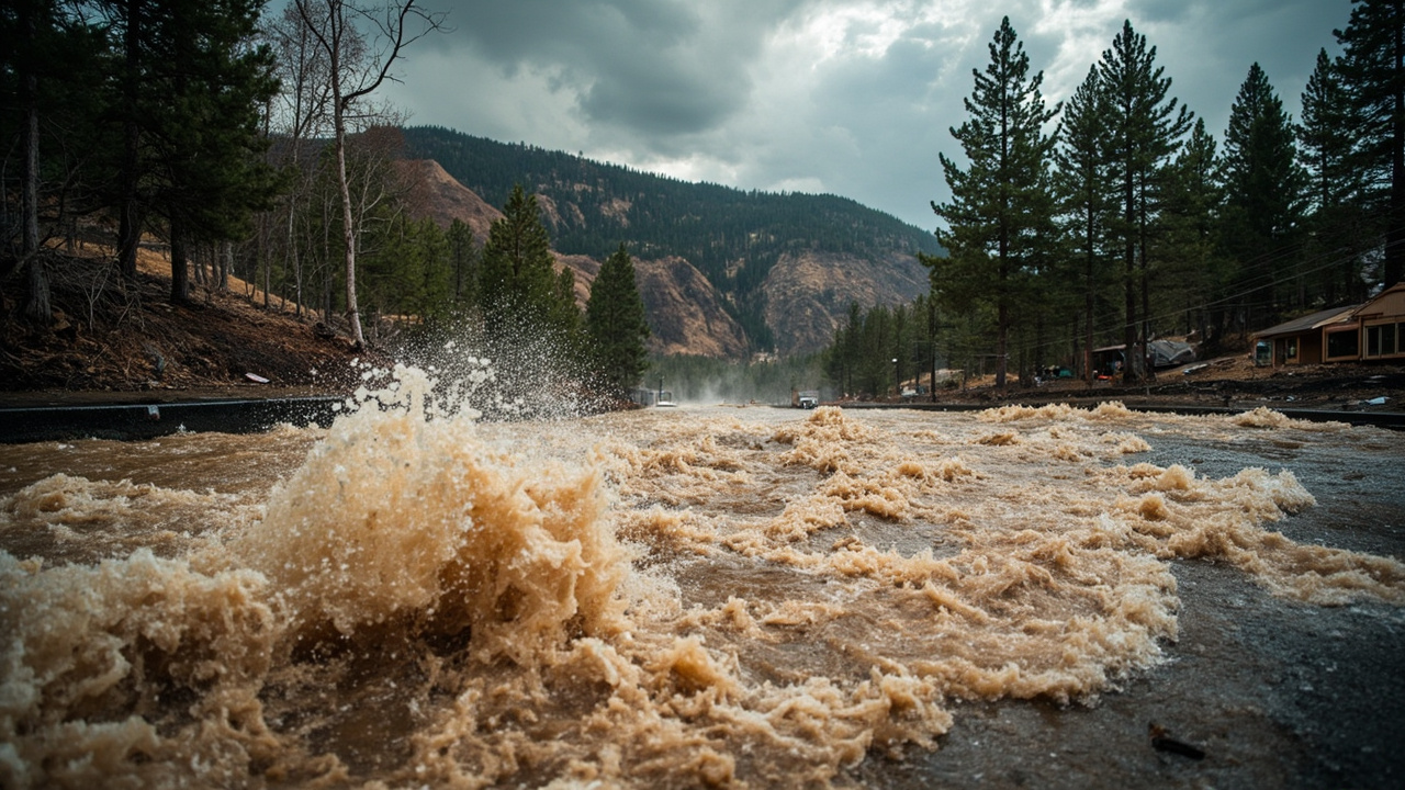
Flash flooding was already occurring in the Ruidoso area of south-central Lincoln County on the morning of Wednesday, September 16, 2026, with emergency management reporting flooding downstream of the Salt burn scar and the National Weather Service keeping a Flash Flood Warning in effect until 9:30 a.m. MDT for Ruidoso, Ruidoso Downs and Hollywood.
That is the core of the September 16 news day in Lincoln County, New Mexico. According to the National Weather Service warning republished as “FLASH FLOOD WARNING REMAINS IN EFFECT UNTIL 930 AM MDT THIS MORNING FOR SOUTH CENTRAL LINCOLN COUNTY,” up to 2 inches of rain had fallen by 6:40 a.m. MDT, rainfall rates were expected near 2 inches in 1 hour, and additional rainfall up to 1 inch was possible. According to a later update to the same warning, at 8:07 a.m. MDT emergency management continued to report flash flooding in the Ruidoso area while rainfall rates were decreasing but up to 0.75 inches more remained possible.
What officials confirmed Wednesday morning
Warning period and hazard level
The National Weather Service office in Albuquerque issued the continuing Flash Flood Warning for south-central Lincoln County for the morning of September 16, with an expiration of 9:30 a.m. MDT. According to the National Weather Service warning republished by Forth, the hazard was described as life-threatening flash flooding produced by heavy rain, with flash flooding already occurring at the time of both the 6:40 a.m. and 8:07 a.m. MDT statements.
The source for the flooding report in both statements was listed as emergency management. According to the 6:40 a.m. MDT statement, emergency management reported flash flooding in the Ruidoso area, including areas downstream of the Salt burn scar. According to the 8:07 a.m. MDT statement, emergency management continued to report flash flooding in the Ruidoso area, including areas downstream of the Salt burn scar.
The warning language listed the impact as life-threatening flash flooding of creeks and streams, urban areas, highways, streets and underpasses. That wording appeared in both morning updates carried by Forth on behalf of the National Weather Service.
Rainfall reports in the warning
According to the 6:40 a.m. MDT National Weather Service statement, up to 2 inches of rain had fallen in the warned area. The expected rainfall rate was stated as 2 inches in 1 hour. Additional rainfall amounts up to 1 inch were described as possible in the warned area.
According to the 8:07 a.m. MDT update to the same National Weather Service warning, up to 2 inches of rain had fallen and rainfall rates had been decreasing. Additional rainfall amounts up to 0.75 inches were still described as possible in the warned area.
Local reporting was consistent with those totals. According to KOB 4 in “Ruidoso braces for flooding threat,” parts of the area saw between 1 and more than 2 inches of rain earlier in the day on Wednesday. According to KOB 4 in “Flash flood watch in western and central New Mexico as heavy rain hits,” in Ruidoso between 1 and more than 2 inches of rain fell in only about one to two hours earlier in the day.
Places named in the September 16 warnings
Communities and roads in the alert
According to the National Weather Service warning republished by Forth, some locations that would experience flash flooding included Ruidoso, Ruidoso Downs and Hollywood. That three-community list appeared in both the 6:40 a.m. and 8:07 a.m. MDT statements for September 16.
According to the 6:40 a.m. MDT statement, emergency management reported flash flooding in the Ruidoso area, including along Cree Meadows Drive, White Mountain Drive, and along Cedar Creek and Fence Canyon. Those street and creek names give households a specific focus for checking local road status and avoiding low crossings near those corridors during the warning period.
The warning did not list a completed evacuation order for September 16 morning. It listed the observed condition as flash flooding already occurring and directed residents to avoid driving on flooded roads.
Burn-scar context for Lincoln County
According to the National Weather Service warning, the flooding included areas downstream of the Salt burn scar. Burn-scar areas were a repeated concern in September 16 coverage because burned ground sheds runoff quickly into creeks and downstream neighborhoods.
According to KOB 4 in “Flash flood watch in western and central New Mexico as heavy rain hits,” the main concerns for the evening included heavy rain, arroyos filling quickly, low-water crossings, urban flooding and burn scar flooding. According to that same KOB 4 report, a flood watch remained in effect for parts of western and central New Mexico, including the Frijoles burn scar area.
How much rain fell and what was expected next
Wednesday daytime rates
The defining feature of the September 16 event was rainfall rate rather than day-long totals. According to the National Weather Service, the expected rainfall rate around 6:40 a.m. MDT was 2 inches in 1 hour. According to KOB 4, the 1 to more than 2 inches that fell earlier Wednesday arrived in only about one to two hours, a rate that the station reported can produce flash flooding very quickly.
According to KOB 4 in “Ruidoso braces for flooding threat,” Ruidoso leaders said they were ready for flash flooding as the village braced for storms on Wednesday, and residents and village leaders continued to watch flooding risks because a small amount of rain can quickly turn serious in Ruidoso.
Resident Marian Black, who spoke to KOB 4, said she has lived in her home in Ruidoso since 1980 and lives next to the river. Black said she had not seen much damage at her home from the fires and floods, but the worry about flooding this late in the year felt unusual. KOB 4 quoted Black describing the summer as wonderful and noting warnings that conditions would continue into the next day.
Wednesday night into Thursday morning outlook
According to KOB 4 in “Flash flood watch in western and central New Mexico as heavy rain hits,” near-record mid-September moisture would keep heavy rain and flash flood concerns in western and central New Mexico through Thursday morning. Chief Meteorologist Eddie Garcia’s report described a very moist monsoon pattern continuing across New Mexico Wednesday evening, with the deepest moisture focused in western and central parts of the state.
According to that KOB 4 forecast, showers and thunderstorms would continue to increase Wednesday evening around Farmington, Gallup, Grants, Silver City, Reserve, Socorro, Albuquerque, Santa Fe, Los Alamos, Ruidoso and Cloudcroft. The report said places that saw breaks in the clouds could quickly get heavy rain, while areas that stayed cloudy longer might see less intense storms.
For overnight hours, KOB 4 reported that rain was not expected to shut off after sunset and that showers and periods of rain would continue through much of the night, especially across western New Mexico. According to the same report, better overnight coverage included Farmington, Gallup, Grants, Silver City, Reserve and Socorro, with a few rounds of rain also possible around Albuquerque, Rio Rancho, Santa Fe, Los Alamos and Ruidoso.
For Thursday, KOB 4 reported another active weather day as deep monsoon moisture stayed in place, with thunderstorms developing over the mountains during the afternoon. According to the report, the best coverage would be around Silver City, Reserve, Gallup, Grants, Farmington, Socorro, Santa Fe, Los Alamos, Taos, Ruidoso and Cloudcroft, with Albuquerque and Rio Rancho also having another good chance for showers and thunderstorms. Some stronger storms could produce 1 to 2 inches of rain, according to KOB 4, with storms moving north and northeast at about 20 to 25 mph. The report added that several storms could follow the same path or redevelop along the south and southwest sides of the mountains, keeping flash flooding possible.
Schools closed and village crews prepared
Ruidoso Municipal Schools closure
According to the Ruidoso Municipal School District notice titled “Wednesday, September 16, 2026,” all Ruidoso Municipal Schools were closed Wednesday due to current weather conditions. The district described the notice as an urgent weather closure.
According to the same district notice, buses serving the Ruidoso area were parked at Central Office, while buses serving the Alto area were parked at the Shell Station in Alto. Parents and guardians were asked to pick up their children as soon as possible, while traveling only when it is safe to do so. The district asked families to use caution on area roads and prioritize family safety.
The closure message listed the district address as 200 Horton Circle, Ruidoso, NM 88345, with phone contact at (575) 630-7000. For households, the operational detail was the split bus locations and the instruction to travel only when safe for pickup.
Swift-water teams, basin and sandbags
According to KOB 4 in “Ruidoso braces for flooding threat,” village leaders said they had trained swift-water teams and added tools including a detention basin to help with flooding. Deputy Manager Heath Dobrovolny described the basin function as helping take the peak rush of water off and then allowing it to release slowly over time.
KOB 4 quoted Dobrovolny calling that approach one of the most effective tools for flood mitigation and noting that measures such as cross vein weirs or check dams can also be done to help soften flood flows. Dobrovolny also said the village had provided sandbag distribution sites through the summer at the convention center and at Wingfield Park, according to KOB 4.
What households were told to do
Driving and road safety
According to the National Weather Service warning, residents were told to turn around and not drown when encountering flooded roads. The warning stated that most flood deaths occur in vehicles and directed people to be aware of surroundings and not drive on flooded roads.
That driving message was repeated in both the 6:40 a.m. and 8:07 a.m. MDT statements on September 16. For household planning, the practical step stated in the warning was to treat any flooded road as closed and to avoid highways, streets and underpasses where flash flooding of urban areas was listed as an impact.
Monitoring creeks, streets and underpasses
According to the National Weather Service, the expected impacts included flash flooding of creeks and streams, urban areas, highways, streets and underpasses. Households near Cree Meadows Drive, White Mountain Drive, Cedar Creek and Fence Canyon had a specific reason to monitor local conditions during the warning window because emergency management named those corridors in the 6:40 a.m. MDT report.
According to KOB 4, concerns also included arroyos filling quickly and low-water crossings becoming hazardous. Those features can rise without heavy rain directly overhead when runoff moves down from higher terrain and burn scars.
Planning for continued rain
According to KOB 4, showers and periods of rain were expected to continue through much of the night in parts of western New Mexico, with additional rounds possible around Ruidoso. Households were therefore dealing not with a single morning storm but with a pattern that could add up to 1 inch more during the morning warning period, up to 0.75 inches more in the later update, and 1 to 2 inches from stronger storms on Thursday, according to the National Weather Service and KOB 4 figures for those separate periods.
The district’s pickup instruction captured the household priority for September 16: pick up children as soon as possible, while traveling only when it is safe to do so, using caution on area roads. That instruction, published by the Ruidoso Municipal School District, linked school operations directly to road safety during the warning period.
Sources referenced
- FLASH FLOOD WARNING REMAINS IN EFFECT UNTIL 930 AM MDT THIS MORNING FOR SOUTH CENTRAL LINCOLN COUNTY | National Weather Service | Forth (https://www.forth.news/lists/nws/Cf78saguWnx3fotgRFGSB)
- Ruidoso braces for flooding threat - KOB 4 (https://www.kob.com/new-mexico/southeast-new-mexico/ruidoso-braces-for-flooding-threat/)